From Las Vegas Nevada
Through Bolder
Nevada to Kingman Arizona
Through Oatman and Topock to Needles California
Distance traveled
– 153 miles
 |
| Entering Historic Boulder City |
Today it was time to get back to route 66 after this amazing side trip
and stay in Las Vegas. Packing my gear
back into the car I made my way back on the open road. First I made a stop at Sam’s club for gas and
then I was heading south to Boulder City.
Driving through historic down town was interesting but mostly it seemed
very commercial with very little feeling of “history”. Maybe I just did not see the historic places?
 |
| view to the Colorado River from scenic overview on Hwy 93 |
Then it was time to find Hwy 93 south toward Kingman Arizona. Crossing the big Hoover Dam Bridge offers
views of the surrounding mountains but the walls are too high to see into the
valley below for glimpses of the Colorado River. For that I had to cross into Arizona and stop
at a road side scenic overlook. There,
in a huge vista of hills and valleys lay the ribbon of the Colorado just
visible in the distance.
More driving brought me to Kingman where I rejoined route 66 starting
with the Route 66 Museum where I learnt that the wagon trains west used this
route before it was paved for automobile use.
From there I stopped at the Mohave Museum for some history of the
area. Then it was back on the road again
following the Route 66 signs.
This stretch of the Old Route 66 is just a fabulous drive on old
roadway. This is the stretch that goes
back in history to the time of the wagon trains. I loved this stretch of the
road as it gives a real glimpse into the past.
 |
| flooded "dip" on Old Route 66 |
One of the first “reality checks” I came upon was a minor flooding in a “dip”. Basically, when it rains the waters collect
in the “wash” and if the “wash” flows across the road the “dip” channels the
water across the road to the other side to continue the downhill flow toward
the river.
Slowing down to cross this “river
of water” on the old road is like a step back in time. I read that when there was too much flooding
and the road became impassible, traffic just stopped as everyone waited for the
flooding to pass. Luckily there were
only inches of water in the dip today and I was able to drive on.
 |
| Living History on Route 66 |
All alone on the road; except for the occasional car going in the other
direction, I made my way slowly up the long hill toward the mountains in the
distance. At the top of the slope there
was a reminder of the past with an old time hotel and gift shop with amazing
views to the surrounding countryside.
 |
| from road to steep drop off to amazing view |
Continuing west is one of the most scenic sections of the road. Not only is this section of the old road an
incredibly scenic drive, but the winding roads have no safety barriers on the
edges! It is up to the driver to
navigate carefully the sharp curves and hairpin turns that climb into the hills
and up to the Sitgreaves Pass (elevation 3550).
This section of the road was for me a real reminder of our shift in
values from “be ware and watch out for yourself” to our current belief that we
have to protect everyone from themselves.
As I drove this section of the road I tried to imagine wagon trains on this
route. Imagine people traveling from
water hole to water hole. Climbing the
dangerous switchbacks focused on arriving at the next source of water before
the water barrels were empty. I imagine
them looking out at this same view and marveling at the vastness of the desert.
Would they appreciate the beauty or were
they too concerned with survival?
What was life like on a wagon train?:
The original 300 mile passage (Beale’s Wagon Road) was explored and mapped out by Edward F. Beale using “a crew of 100 men and 22 camels”
Building of Beale’s Wagon Road:
|

From Sitgreaves Pass it was mostly downhill all the way to Oatman.
 |
| Traffic jam in Oatman - 3 burrows and a camper |
Oatman is a very picturesque place, a link to the past, like stepping
into a story book or an old western movie.
Burrows wander the street and look into the shops. Burrows park themselves beside parked cars or
contribute to a traffic jam. They have
been given the right of way in this town as if they are just waiting for their
old timers to finish a drink at the local bar before heading back out into the
mines in the hills.
 |
| Blowing sandstorm across route 66 |
On the way to Topock the hills are left behind and in the vast flat
expanses the dust is picked up by the winds and driven in every direction. I got to experience my first sand storm! At first it was off
in the distance and then up close and personal, blowing hard and whipping the sand across the
road. On some stretches I had almost no
visibility and at one point in time, near Topock, I just pulled to the side of
the road to while I used my Garmin to look at how much further to Needles. Luckily it was not that far and so driving
very slowly I made my way toward me destination.
 |
| View to Goose Lake |
Gradually visibility improved. To the left I saw Goose Lake.
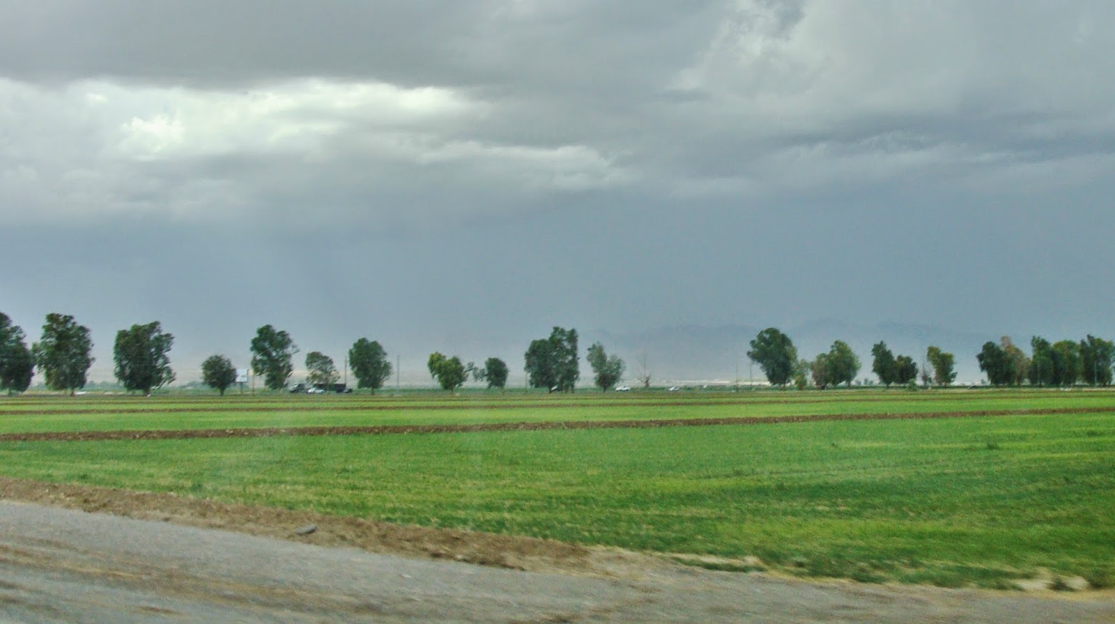 |
| From desert to green fields via the power of irrigation |
Not much further and then I
started to see irrigated fields and I knew that I was very close to the Colorado
River.
I crossed the bridge over the Colorado River and entered Needles
California. I am out of the mountain range I just passed
through and elevation here 495 ft (151 m).
Along the historic section of route 66 through town I found a quaint
motel, River Valley Inn, where I
stayed the night. With the blowing sand
and the dark rain clouds overhead I did not think that tonight would be a good
camping night.
Renate Dundys Marrello
2014 - 08 - 19
Photo Link:
No comments:
Post a Comment