Tuesday, September 30, 2014

2014 – 08 – 22: Day 31 – Road Trip Across the USA - starting route 6 east

From Long beach  
To Red Rock State Park
Distance: 144 interstate and highway miles
+ ?? city streets and sight-seeing exits and canyon road 

Today is the beginning of the next part of my adventure, the start of route 6 heading east.

I was up fairly early but waited until the morning rush hour to taper off before heading on the road.  Since I am trying to follow the original route 6 (which does not exist anymore) I chose to follow route 110 northbound through Carson and into Los Angeles.  This route allowed me to see the city streets and neighbourhoods that you don’t get to see when on the major arteries. 

 
(for more information see http://www.route6tour.com/history.htm)

I got to see lots of examples of the working class neighbourhoods, the shabbier side of LA if you will.  One of the things that really struck me was the fences.  

work place or prison?
Fences and barbed wire were everywhere!  

People opting to jail themselves in order to feel protected.  I think the fences keep people in as much as they keep crime out.   


For a Toronto gal like me it is a hard scene to face.  Even in our working class neighbourhoods we don’t fence ourselves in.  We create privacy fences of wooden lattice and greenery.  We create enclosed spaces where we can connect with nature and celebrate family events.  But we don’t put up 8 foot steel fences or barbed wire.  Our front yards are open and welcoming not barred and looking like a war zone.  It was a most depressing drive for me to see the lengths that these people feel they need to go to in order to feel safe.

Garment Center 
I also got to see a different slice of LA down town.  Driving through Latino Land, the Garment Center, Little Tokyo, the Warehouse district and Historic Filipino town was a read educational experience.


Fountain in Echo Park 


Echo Park was a pleasant escape from all of that and was filled with people enjoying a warm and sunny day.


After all of this time of inner city driving I was glad to get onto the major artery to Glendale.  Here you start to see the suburban life.  More upscale shops and fancier homes.  I continued north on 5 through miles and miles of LA suburbs one after the other looking rather cookie cutter from the freeway…shopping malls and fast food restaurants being the connecting theme.  


suburb in the foreground - desert in the background
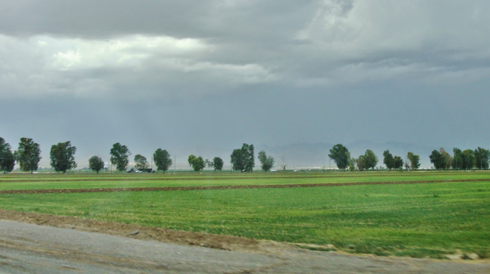
Along the route there is this strip of artificial greenery created by the people who live there while the barren hills behind the developed area were grey with sparse desert vegetation


I stopped at the Sam’s in San Fernardo, but there were no gas pumps there, so with a hot dog combo I continued to the Sam’s in Santa Clarita where I was able to fill up the tank.

This is where I connected with route 14 toward Placerita.  There even was an opportunity to get off of the big artery for a while and enjoy a trip through Soledad Canyon.  

The rive creates a ribbon of green in the desert 
This section was very scenic and revealing the scarcity of water throughout this region.  Near the river in the Solddad Canyon there is a strip of greenery and then just a few feet beyond that the desert takes over again. 


From Placerita to Palmdale and even Lancaster I felt like I was in a suburban bedroom community where people come to spend their evenings only to leave for work each morning on the crowded expressways to the LA hub.  Each community a bit newer than the last as the urban sprawl spreads out from the older city centre. 

Historic building in Rosamund
Now I finally hit the wide open desert and in Rosamund there was this old town feeling like nothing has changed there in the past 50 years.  The old motels the coffee shops reminiscent of the 50’s still stand in the midst of this vast desert.

 
the road into Mojave


Mojave is clearly a pass through town where possibly you might look for a motel if you arrived there at the end of the day.  There is nothing but desert everywhere you look.  Cantile is off to the side barely visible from the highway.

By now it was late afternoon and I decided to stop for the night at Red Rock State Park.  There were no rangers on duty so it was pick a site and drop your payment envelope in the deposit box.  As I arrived at 5:30 PM I was the only one there.   

cliffs in shadow while the sun still shines in the distance 
The sun was setting behind the cliffs by 6 PM and giving me the only shade available.  It was incredibly windy.  I had to really tie down the netting.  I don’t know if there will be any bugs with this dry dry air, if they are here they will certainly come out in the evening.  The wind is howling in my ears …why am I surprised that it is so windy?  


I see two cars pull through looking…but they don’t stay.  Will I be alone in the desert tonight?  Will this be my chance to experience the solitude in the desert.   Well I have comforts like a nice bed, plenty of water, food and even toilets nearby.  Not a hardship like a right of passage in the desert but, close enough.

The quiet has been broken – I hear the sound of voices carried on the wind…so somewhere there is another group camping.   Then as it gets dark a few more vehicles arrive and I see a campfire off in the distance. 

the sun is behind the cliffs but
out in the valley the lingering sun still shines
When the sun goes down behind the cliffs, the shadows lengthen but in the distance you can still see the sun reflection off the desert sand…and then that too becomes dark. 


Time for dinner and then get into my car bed for the night.  I tuck the tent material into the doors so that they won’t be blown off in the night.  I fall asleep to the sound of the howling wind and flapping of the fabric of my bug tent.

Renate Dundys Marrello 
2014 - 08 - 22 

Photo Link:


Tuesday, September 23, 2014

2014 – 08 – 21: Day 30 – Road Trip Across the USA – Route 66 – final stretch to the Pacific Ocean

Part 1:  From Victorville to Santa Monica – finishes route 6
Distance traveled:
100 interstate miles  +  ?? route 66 byways.
Part 2 From Santa Monica to Long Beach – connecting side trip to start route 6 east
Distance traveled: 44 miles staying along the coast

Today marks my last day on route 66.  To celebrate I decided to include breakfast at the Historic Summit Inn.  It seems good fortune was on my side.  As I was leaving Victorville the digital road display signs indicated an accident ahead.  I got off the interstate at Cajun pass just as traffic ground to a halt.  
Breakfast at Summit Inn
I enjoyed a delicious breakfast in a nostalgic setting watching the traffic on the interstate inch by.  I enjoyed an extra cup of coffee and a cinnamon bun and watched more traffic crawling along.  Luckily by the time I finished and paid the blockage had finally been cleared I had smooth sailing through the pass and down into the valley. 

Last stretch of original road.


Most of the drive to San Bernardino was on the interstate  but there was one last stretch of original road following a dry riverbed.


Historic Theater in San Bernardino 


Once in San Bernadino I followed the now busy city route to see the historic theatre and then the Wig Wam Motel.  


I remembered that this is the area where Simon Reeve used to live and work and took and extra road view picture thinking of him. 

Today's traffic is a stark contrast to yesterday's empty roads 
After a stop at Sam’s for gas and some groceries, I followed the major artery route to Santa Monica.  I really had no interest in stop and go city drive all the way through to the coast.  The drive to Santa Monica was very smooth and I reflected on the stark contrast between yesterday’s drive on mostly deserted roads to today’s big city congestion. 

The end of the road is in sight 
Santa monica beach & pier is a crazy busy place, so many people.  Crazy parking prices $12.00 and crowded with throngs of beach goers.   A quick drive around to rubber neck and get the feeling of the place was enough for me and with a last look at the beach I said goodbye to my route 66 journey.


Venice Beach 
The next part of my adventure was a drive south along the coast to Long Beach. Once I got past the worst of the stop and go traffic it was very pleasant, seeing all the beaches.  First I drove past Venice Beach and then Dockweiler State Beach.  


Past the beaches the road climbed up into the hills still following the coast and I was able to stop at some very scenic outlooks in Torrence and Palos Verdes. 
Point Vicente Lighthouse 
My favorite stop was Point Vicente, where I enjoyed the park with the lighthouse…ate my afternoon snack overlooking the pacific.
Smell of the ocean and the taste of moisture in the air were especially poignant after all the days spent in the arid desert. 


As the sun started to get lower in the horizon I completed my route around the peninsula to Rancho Palos Verdes through Los Angeles Harbour and into Long Beach. 
It took some searching to find a suitable place for the night.  There were no camp grounds around so I had to look for motel for the night.  Some of the places looked like real dives!  I ended up at Days Inn which looked respectable.  After settling in for the evening and enjoying my dinner I spent some time working on notes and pictures and preparing the route for my drive the next day.

And so ends the route 66 portion of my road trip and the transition to the start of route 6 headed back east.  Tomorrow I will start the next stage of my trip - back east on route 6.

I want to say a special thank you to my friends (you know who you are!!)  that sent me the wonderful guide book for route 66.  It was a great help and I learnt so much reading Tom Snyder's interesting stories about the history of the road. 

Renate Dundys Marrello
2014 – 08 – 21 

Photo Link: 

Sunday, September 21, 2014

2014 – 08 – 20: Day 29 – Road Trip Across the USA – route 66 from Needles to Victorville - experiencing the Mojave Desert

From Needles California 
To Victorville California   
Distance traveled:    174 interstate miles  +  ?? route 66 byways.

The skies were bright and clear after last night’s rain.  As I left Needles I looked for ways that I could explore more of the Colorado River Valley.  Driving on the old Needles Highway it is a learning experience for me to see green on the river side of the road – and desert on the side away from the river.  


irrigation makes the desert green 
 The river itself is not visible and so I decided to try “River Road” to explore.  I saw many fields of irrigated crops but after a couple of miles I was no closer to the river so I turned around and made my way back to Needles Highway.


rain water in the "dip"
The dips in the road, showed evidence of last night's rain where the “washes”  collected water and it raced downhill to the Colorado. 


Because of yesterday’s rain I encountered my first road closure by the Avi golf course / Casino.  Road closed due to flooding.  And so my exploration of the Colorado River Valley was at an end and it was time to back track several miles to get back to the interstate. 

route 66 to Goffs closed due to flooding
A try to get onto old route 66 towards Goffs also failed due to flooding and once again it was time to head back to the interstate.  I got to watch a big truck making a U-turn because of the closure, and then saw a pickup truck inch around the barrier.  I am assuming this was a local driver who figured that his truck could navigate the flooded dips.

A short drive on the interstate and another exit for the national historic road and this time I met with success and no road closures.

As I was driving the desert through barely remembered downs like Essex and Chambles to Ludlow, I tried to imagine the conditions covering these distances in a covered wagon as part of a wagon train.

“By wagon train going cattle speed (Under normal conditions a wagon train pulled by mules could make from 15-25 miles a day. Horses and mules went about 3-4 mph. They required more rest and forage than oxen. If they were pulled by the reliable oxen they made 1-2 miles per hour. Oxen were cheaper …Oxen were also less likely to be stolen by Native Americans. I mean, what self-respecting Plains Indian would ride an oxen? They didn't stray and could be used as farm animals when the destination was reached.”

At 55 miles per hour in 2 hours that is approximately 110 miles that I covered in the comfort of my car. So with oxen pulling the wagon for 12 hours per day you cover about 20 miles.  So what I covered in 2 hours would take approximately 11 days by wagon!

What would this journey feel like at that pace…taking days covering what I did in a matter of hours?
What would be on their minds and in their emotions knowing that in all that vastness there are few sources of life sustaining water?  What does is feel like to know that the food stores that you have packed and brought with you are all the sustenance you have until you reach your destination?   And Ludlow is not the end of the journey…the desert goes on!

Lettering in the desert
After passing Essex I started noticing letters formed out of rocks along the low embankment to my right.  I wondered who put them there and why.  


Later when I had internet access I looked for information and this is what I found:

Names in Rocks – 1942-72
Mojave Desert between Essex and Ludlow

…With World War II over, civilian travelers learned that route 66 in the Mojave Desert was a dangerous place.  The eighteen-foot bridges that crossed the washes were too narrow for two speeding cars to pas safely in opposite directions. One care would hit another or worse, impale itself, and sometimes the driver, on the wooden guardrail.  Every wrecker had a litany of horror stories.  But vapor locked gas lines and overheated radiators stopped more cars than did guardrails. Folks sat on the roadside, their radiators boiling, waiting for a wrecker to tow them to the nearest garage.  Bored, they collected small stones and laid them on the roadside berms in the shape of big letters spelling out their names.

What was the purpose of the low berms?  These were levees.  When it rains in the desert, it floods.  The berms that lined the north side of the highway funneled floodwater away from the road and into the washes.

from the book Along Route 66 by Quinta Scott.


All alone  on the deserted road in the desert 
Driving across this desert I found myself taking lots of pictures of this road in the desert, and mountains in the distance. I am trying to preserve in my photos the feeling of driving miles and miles and miles and seeing hardly any signs of human activity.  I wanted to capture the feeling of expansive wide open spaces so inhospitable to people.  My goal is to create a photographic journal that reflects the emotional experiences of this journey.


for a moment I don't feel so all alone as I watch the train
on the distant tracks passing by 
Most of the time I was the only vehicle on the road.  Highlights of the lonely drive were glimpses of the interstate far off in the distance, or a train passing by.  


Sometimes as I stopped to take a picture of a route 66 relic I would be joined by one other lone tourist.  Some of the isolated homes showed signs of life with a current vehicle parked in the yard.  I tried to imagine living here!   I can’t even begin to fathom what life would be like so far from any urban centre. 

In Ludlow I stopped at a gas station to top up the gas tank and then because route 66 past Ludlow is not maintained, I took the Interstate to Barstow.

Sandstorm in the distance 
While on Interstate 40 I observed a sandstorm off to the left.  There were swirling clouds of dust obscuring a few ranch homes at the base of the mountain. 


As soon as I saw the exit sign for route 66 I was once again away from the traffic and in near isolation I drove across
lonely left over from a bygone era 
more of the desert towards Barstow.  Scattered remains are a legacy of the past when this was the only highway across this desert.   


Those towns bypassed by the interstate became isolated and the abandoned.  Cars travel faster and farther on a single tank of fuel and so service areas become the focal points along the interstate.  We live in different times, where speed and efficiency have won out over the experience of the road itself.  A quick snack at a modern chain restaurant is the norm and the small owner operated coffee shops and lunch stops have become a nostalgia item rather than the norm.

Barstow and eclectic mix of old and the new
Barstow is one of those communities that survived the transition from old route to interstate town.  It has all the new and modern chain stores and yet the old motels still survive here. 


Barstow Harvey House 
While in Barstow I stopped to see the Railway Museum. I loved the architecture of the  “Barstow Harvey House”, the hotel at the railway station, it is a real beauty! 


Unfortunately the railway museum is only open on the weekends so I was out of luck for the opportunity to explore that bit of history. 

Storm clouds gathering 
For the next stretch of the journey I followed the old route 66 to Victorville.  The sky got progressively darker as storm clouds gathered.  


Landmark in the desert - Elmer's Bottle Tree Ranch
There is dry desert everywhere I look, with the occasional point of interest like Elmer’s Bottle Tree Ranch and the Iron Hog Restaurant and Saloon. 


I passed through Oro Grande, looking like a relic from a bygone era, and then suddenly there is this modern town built Victorville growing up out of the desert! 

Victorville nostalgia and modern living side by side 
 Here there is once again that mixture of old and new, the historic district and the modern shopping area all grown together on the edge of the interstate.


I stopped at McD’s to check my email messages.  I was hopeful of having a message from one of my FB friend that lives nearby, but sadly that meeting was not meant to be. 

The sky continued to darken, the clouds were almost black and then saw it start to rain...yes once again I am followed by rain, I know it is the monsoon season and yet these torrential rains in the desert come as a surprise to me.  

I did some shopping for groceries and because of the rain I chose the Mojave Motel over the Mojave Campgrounds.  A quiet evening of notes and picture editing and then sleep are just what this road weary traveler needs tonight. 

Renate Dundys Marrello 
2014 – 08 – 20

Picture Link:

Friday, September 19, 2014

2014 – 08 – 19: Day 28 – Road Trip Across the USA – rejoining route 66 in Kingman and heading west again.

From Las Vegas Nevada 
Through Bolder Nevada to Kingman Arizona
Through Oatman and Topock to Needles California
Distance traveled – 153 miles

Entering Historic Boulder City 
Today it was time to get back to route 66 after this amazing side trip and stay in Las Vegas.  Packing my gear back into the car I made my way back on the open road.  First I made a stop at Sam’s club for gas and then I was heading south to Boulder City.   Driving through historic down town was interesting but mostly it seemed very commercial with very little feeling of “history”.  Maybe I just did not see the historic places?


view to the Colorado River from scenic overview on Hwy 93 
Then it was time to find Hwy 93 south toward Kingman Arizona.  Crossing the big Hoover Dam Bridge offers views of the surrounding mountains but the walls are too high to see into the valley below for glimpses of the Colorado River.  For that I had to cross into Arizona and stop at a road side scenic overlook.   There, in a huge vista of hills and valleys lay the ribbon of the Colorado just visible in the distance.


More driving brought me to Kingman where I rejoined route 66 starting with the Route 66 Museum where I learnt that the wagon trains west used this route before it was paved for automobile use.  From there I stopped at the Mohave Museum for some history of the area.  Then it was back on the road again following the Route 66 signs.

This stretch of the Old Route 66 is just a fabulous drive on old roadway.  This is the stretch that goes back in history to the time of the wagon trains. I loved this stretch of the road as it gives a real glimpse into the past. 

flooded "dip" on Old Route 66 
One of the first “reality checks” I came upon was a minor flooding in a “dip”.  Basically, when it rains the waters collect in the “wash” and if the “wash” flows across the road the “dip” channels the water across the road to the other side to continue the downhill flow toward the river.  


Slowing down to cross this “river of water” on the old road is like a step back in time.  I read that when there was too much flooding and the road became impassible, traffic just stopped as everyone waited for the flooding to pass.  Luckily there were only inches of water in the dip today and I was able to drive on.

Living History on Route 66 
All alone on the road; except for the occasional car going in the other direction, I made my way slowly up the long hill toward the mountains in the distance.  At the top of the slope there was a reminder of the past with an old time hotel and gift shop with amazing views to the surrounding countryside.


from road to steep drop off to amazing view
Continuing west is one of the most scenic sections of the road.  Not only is this section of the old road an incredibly scenic drive, but the winding roads have no safety barriers on the edges!   It is up to the driver to navigate carefully the sharp curves and hairpin turns that climb into the hills and up to the Sitgreaves Pass (elevation 3550).  This section of the road was for me a real reminder of our shift in values from “be ware and watch out for yourself” to our current belief that we have to protect everyone from themselves.

As I drove this section of the road I tried to imagine wagon trains on this route.  Imagine people traveling from water hole to water hole.  Climbing the dangerous switchbacks focused on arriving at the next source of water before the water barrels were empty.  I imagine them looking out at this same view and marveling at the vastness of the desert.  Would they appreciate the beauty or were they too concerned with survival?


What was life like on a wagon train?:

The original 300 mile passage (Beale’s Wagon Road) was explored and mapped out by Edward F. Beale using “a crew of 100 men and 22 camels”

Building of Beale’s Wagon Road:

Beale's camels - picture from Harper's Express


From Sitgreaves Pass it was mostly downhill all the way to Oatman.

Traffic jam in Oatman - 3 burrows and a camper
Oatman is a very picturesque place, a link to the past, like stepping into a story book or an old western movie.  Burrows wander the street and look into the shops.  Burrows park themselves beside parked cars or contribute to a traffic jam.  They have been given the right of way in this town as if they are just waiting for their old timers to finish a drink at the local bar before heading back out into the mines in the hills.  

Blowing sandstorm across route 66 
On the way to Topock the hills are left behind and in the vast flat expanses the dust is picked up by the winds and driven in every direction.  I got to experience my first sand storm!  At first it was off in the distance and then up close and personal, blowing hard and whipping the sand across the road.  On some stretches I had almost no visibility and at one point in time, near Topock, I just pulled to the side of the road to while I used my Garmin to look at how much further to Needles.  Luckily it was not that far and so driving very slowly I made my way toward me destination.  

View to Goose Lake 
Gradually visibility improved.  To the left I saw Goose Lake. 


From desert to green fields via the power of irrigation 

Not much further and then I started to see irrigated fields and I knew that I was very close to the Colorado River.


I crossed the bridge over the Colorado River and entered Needles California.  I am out of the mountain range I just passed through and elevation here 495 ft (151 m). 
Along the historic section of route 66 through town I found a quaint motel, River Valley Inn, where I stayed the night.  With the blowing sand and the dark rain clouds overhead I did not think that tonight would be a good camping night.

Renate Dundys Marrello 
2014 - 08 - 19 

Photo Link: