Saturday, June 27, 2015

2015 - 06 - 19: Day 5 of Scenic Destinations

Day 5
From Brule WI
To Delagoon Park in Fergus Falls MN 
Distance Traveled: 240 miles 

Brule River 
After packing up my campsite it was just a short drive to a short hike to see the Brule River.  I loved the blue reflection of the sky in the water


along hwy 2 a quaint antique shop 
From here I continued via Hwy 2 toward Duluth.  This really quaint antique shop called to me so I had to pull in to check it out.  Sadly it was not yet open but I wandered around and enjoyed the delights of the various buildings.


In Duluth  I enjoyed the view as I crossed the bridge over the St. Louis River.  A gas stop at Sam's club and I was on my way once more.  

I followed hwy 210 west through Cromwell to Wright where I stopped for a rest break and a picnic lunch.  


Garrison's "big fish" with view to Mille Lacs Lake 


Continuing through Tamarack, McGregor and then following Hwy 169 to Aitkin so I could stop in Garrison to see the view to Mille Lacs Lake 


view to Rice Lake which is part of the Mississippi River
From there I took Hwy 18 to Brainard where I stopped at Lum Park for view to Rice Lake (which is a part of the Mississippi River.  I also stopped at the Northern Pacific Center  (1511 Northern Pacific Rd) to see the historic rail road buildings that have now been converted to modern usage. 

Now I once more continued west on hwy 210 through Staples and Aldrich to Wadena.  


Now there was a lovely scenic stretch Henning, Vinning, Battle Lake and Underwood into Fergus Falls. I understand this strech of road is called the "viking trail" in honour of the history of the early settlers to this area. 

In Fergus Falls I found a lovely camp site in Delagoon Park on Pebble Lake.  Setting up for the evening went quickly and soon I was relaxing, walking around to enjoy views of the lake and reading as the sun set behind the trees that shaded my camping site.  

Renate Dundys Marrello 

link to more photos

road map from Brule WI to Fergus Falls MN 

2015 - 06 - 20 and 21 : Day 6 and 7 of Scenic Destinations - the wagon train adventure begins

Day 6
From Fergus Falls MN to Jamestown ND
Distance Traveled:  152 miles 

Fergus Falls with overcast skies 
Today is the last travel day to the wagon train adventure.  I awoke to rain and mist and it was a challenge getting ready for the day.  First task, taking down the soaking wet bug net and putting it away was finally accomplished and I headed to McDonald's for wifi and breakfast. 

From there it was time to get on I-94 west to Fargo. 

Here I stopped at Sam’s club and this one actually had a gas pump!!!  I also stopped for a slice of pizza lunch.  Then time to drive the final stretch to Jamestown North Dakota.

I settled into the Jamestown Motel around 3 pm and spent the afternoon relaxing and getting ready for the coming week on the Wagon Train.  I made sure to really enjoy the last night of comfort in a real bed.


I also paused to reflect on the summer solstice, the longest day of the year with the shortest hours of darkness.  Tomorrow is the  first day of summer!

road map from Fergus Falls to Jamestown 

Day 7 
Jamestown ND - Klaus Park to Fort Seward
Distance traveled: 3 miles 

View to James River in Jamestown ND 
I awoke refreshed and ready for adventure.  After a simple breakfast I was on the road to Klaus Park where I enjoyed the peace of the James river flowing by, while reading and appreciating the beautiful day.

Today begins a week of no technology as I endeavor to appreciate what pioneer travel by wagon train felt like.  Do I experience wifi and internet withdrawal?   Yes I do.  Will there be too much thinking time?  Can I fill the silence with meditation and mindfulness?  Will other forms of entertainment or pass times fill the gap?

Final Registration for the Wagon Train Adventure 
After my picnic lunch I headed to Fort Seward and the final registration for the Wagon Train adventure.   

The afternoon progressed smoothly with unpacking and setting up camp site for the evening,
The wagons start arriving 
meeting and getting to know other hardy adventurous people, and watching the wagons and horse teams arriving. 

We had our first sample of wagon train dinning with dinner served at 7 pm.  I enjoyed the roast beef on a bun, the salad, and beans and rice crispy squares for dessert.  This is not real pioneer grub!   I think they would consider this a  feast!

At 8 pm the orientation meeting started and unfortunately the skies turned dark and the thunderheads promised a storm was brewing.  We learned the proper form for getting in and out of a moving wagon.   The wagons do not stop for this and so it is necessary to learn the art of doing so while the horses continue pulling forward.  We were introduced to the all-important safety rules, the medic / first aid staff, and general guidelines for the coming week. 

We learned that we have to check the chuck wagon for KP duties.  My job tomorrow is unloading the baggage wagon in the evening.

My home for the next several days 
Now as the sky progressively got darker with rain clouds, as well as night fall, it was time to settle in for the night.  And then the storm arrived.   The rain was pouring and pounding on my tent roof.  The wind was pushing at the nylon canvas and I fear being blow to Kansas!   The thunder and lightning, oh my!   I tried to get some sleep, wondering if I would remain dry in this deluge.  Between the noise and the worry I did not sleep well until finally at 4 pm the worst of the storm passed and in the ensuing quiet I finally got a few hours of rest. 

Renate Dundys Marrello 

Sunday, June 21, 2015

2015 - 06 - 18: Day 4 of Scenic Destinations

Day 4 
From Bewabic State Park Michigan
To Brule Wisconsin
Distance Traveled:  184 miles

I woke to a world that was soaking wet.  Water was dripping from the leaves and making a splattering noise.  Fog shrouded the distance in mystery.

Only the chirping of the birds broke the silence as I took down a dripping tent and packed it away for travel.

After a quick breakfast of oatmeal and testing out my new “camping drip coffee maker”, I completed the packing routine and headed back to the road.

Bewabic State Park 
The sparkling water of the lake in the camp ground lured me in for a picture. 

My first destination was Chicagon Falls.  I followed the road to Little Lake and caught a glimpse of a deer leaping back into the cover of the trees.  When I got to the cut off to the falls I realized it was time to turn around.  Here the road was totally unserviced with deep holes and big rocks.  I think a jeep would be required to drive there safely.   On a different trip, one with no time constraints, I would park and hike.  It is about 2 miles to the falls.

Along the Apple Blossom trail 
At this early hour of the day I am the only one on the road until I arrive close to Iron River.  From here a short detour takes me to Caspian where I explore a bit of history along the Apple Blossom Trail.

To see Bond Falls I have to take a short detour north on Hwy 45 toward Bruce Crossing.  From Watersmeet it is only about 12 miles and soon I arrive and Bond Falls Road.  Following the signs to the Falls I arrive at the National Forest Parking area and hike to the falls.  

Bond Falls 
What a lovely sight they are!  With the soft colouring enhanced by the backdrop of rain clouds they took on a mystical beauty.  I walked from the base of the falls along the trail, all the way up stream to the small cascades and turbulent waters of the river. Everywhere there was so much beauty to behold.

From there I continued north on 45 to Bruce Crossing and then headed west on Hwy 28 through Bergland and Lake Gogebic to rejoin Hwy 2 in Wakefield.

Ironwood Theatre
In Wakefield Hwy 45 runs right alongside Sunday Lake.  For those with time to spend here there is a camping area right on the lake with a visitors welcome sign.  Hwy 28 ends here at Hwy 2, I turn right and continue west.

I stop in Ironwood to explore the Historic Ironwood Theatre.  The Box Office is open and I walk inside asking if it is possible to see the interior.  One of the kindly ladies took me on a tour and explained the history of the theatre and the restorations that are now taking it back to its original splendor.

Picnic on the shore of Lake Superior in Ashland 


I stayed on Hwy 2 through Bad River Reservation to Ashland where I found a lovely beach front park to sit and enjoy the view to this bay on Lake Superior.  The sun finally decided to come out for a visit and I basked in the glorious warm rays.  What a delightful place for my picnic dinner.

From here I stopped one more time at Prentice Park and another view of the bay before the last stretch of my day’s drive to the town of Brule.  Here I registered for a camp site at the Brule River Motel & Campground. 

I set up my “wet” tent and celebrated that it would quickly dry out with this lovely breeze and the sun shining.   I enjoyed the evening sitting in the warmth of the setting sun doing some knitting and just relaxing.  A perfect ending to a perfect day. 

Renate Dundys Marrello 
2015 - 06 - 18 

See more pictures


My Facebook Reflections Page 

Saturday, June 20, 2015

2015 06 - 17: Day 3 of Scenic Destinations Across the USA

Day 3        
From Headlands Mackinaw City MI 
to Bewabic State Park MI –
Distance traveled:  232 miles

Early morning lights reflected in the clouds
as seen from Headlands Park 
I was up early in the morning when there was still mist in the air and the low lying clouds were tinted pink by the rising sun.


View to the Mackinac Bridge from the Mackinaw Lighthouse 


Leaving my camping place I headed toward the town of Mackinaw City to stop at the lighthouse for a view to the Mackinac Bridge.   


Driving over this amazing bridge is always awe inspiring and today was no exception.  

Then of course I just had to stop a few more times at scenic overlooks to see the bridge in the distance. 


View of Lake Michigan
from the mouth of the Cut River


Continuing on my drive I followed hwy 2 westbound along the coast of northern Lake Michigan.  I stopped at Cut River Bridge for a hike down to the river and a lovely view of the lake. 


View of the Cut River and the bridge above 


The path follows the Cut River inland and you walk under the bridge.

Epoufettte (a small town on the bay) has a lovely rest stop with a scenic view to the lake. 


Further west, I stopped in Naubinway at a "pastie" shop to buy a hot pastie for my lunch.


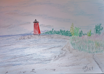
I took my lunch break at the board walk beach were I had a lovely view to the Manistique lighthouse.  I sat on the beach enjoying the sea air, the fresh breeze and the sunshine while getting down to some drawing.  The lighthouse scene was inspiring me to get creative. 

Highway 2 through Rapid River to Gladstone is a very scenic road and you could easily spend an extra day along this section of road stopping for a picnic here, to visit a spring there etc. 

I took a stretch break at the Van Cleve Park in Gladstone where I walked to see this lighthouse and the breathtaking view of the sky above the lake. 


At Escanaba Hwy 2 joins with hwy  35 and turns inland leaving Lake Michigan behind I followed the road to the town of Vulcan where I stopped for the  Iron Mountain Mine tour.  Can you imagine working deep underground with only the light of a candle?


Norway Spring


Continuing west I stopped in Norway at the roadside Norway Spring where I took a moment to sample the refreshing water and to refill my empty water bottles at the spring.


Fumee Falls 


And another stop in Norway was to see the Fumee Falls. There was a lovely trail leading all the way to the top of the falls and from there there  was a beautiful view to the meadow and the trees across the road.   

View of Iron Mountain and surrounding hills 
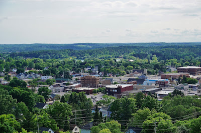
Continuing on Hwy 2 to where it joins Hwy 141 I followed the road to Iron Mountain.  Here I stopped at the “Bat Viewing and Scenic Overlook”.  It was a little tricky to find as the instructions I had found were not very clear. After stopping for directions I found the parking lot and went for a really nice hike to the overlook.  From here the town and the surrounding hills are spread out in a panoramic display.  (If you are looking for this spot stay on Park Ave past East A Street about another 1/4 mile and you will see the sign on the left).

Bridge over Paint River as seen from the boardwalk 
Another short drive brought me to my final stop of the day in Crystal Falls.  Here I stopped in Lincoln Park (on E Crystal Ave) to walk the boardwalk along the Paint River. 


Finally a short drive brought me to Bewabic State Park where I set up camp while looking at the sky and expecting more rain.  Rain clouds were hanging low all evening.  At at midnight for a brief hour the skies turned amazingly clear and the brilliance of the stars left me breathless with wonder and awe.  And then the clouds descended once more and the rest of the night was filled with the sound of raindrops on my car roof lulling me to sleep most soundly.

Renate Dundys Marrello 
2015 - 06 - 17 

see more pictures 


My Facebook Reflections Page 

2015 - 06 - 16: Day 2 Scenic Destinations Across the USA

Day 2 
From Flint Michigan 
To Headlands Park Mackinaw City Michigan 
Distance Traveled: 246 miles 

I awoke to blue skies finally! 


Train Station in Mont Rose 
Then I headed on the road.  I put Ithaca into the GPS to be able to get off of the Interstate for a while. This route along M-57 passed through some lovely scenic towns.  

I enjoyed the train station in Mont Rose and the river front park in Chesaning.


River in Chesaning
Tower of the Fire Hall 

In Ithaca I walked about enjoying the architecture from the 1800’s.

In Mount Pleasant I stopped at the next Sam’s Club!  Guess what!?  Another one with no gas pumps. 


Flowers at a roadside rest  area 


Continuing north I stopped at a rest stop for a lunch and reading break.  


A scenic rest stop 


Then at the next one I stopped for a lie down break as my eyes were sore from the glare of the afternoon sun.   


Hike to scenic view 


At the next one I stopped because I wanted a stretch break and was fortunate as it had a lovely trail to a scenic overlook.


Light though the leaves 

Last bit of a drive brought me to the Headlands Dark Sky Park where I drove around to get the lay of the land.  It is open at all hours to facilitate star gazing so I think I will settle there for the night. 

View from the public beach 
Next I stopped at the public beach on Lake Michigan where I relaxed, did some drawing and some reading. The clear blue sky got more and more overcast as I watched the sun going down.  


View from my beach blanket 


The damp of the beach sand soaked though my beach blanket and left me a bit damp so as the sun went lower and the air got chiller I headed by to The Headlands.
Once settled in I took a walk about to check the sky / cloud conditions.  They are so thick even the final sunset was hidden from view, no vibrant colours just a dimming and fading of daylight.   

The mosquitoes are fierce and so I got into the car and watched the sky get cloudier and cloudier!  

Several others came to gaze at the stars but left disappointed with no view!   Since I was “camping”, I stayed just in case the sky cleared…but it never did.

While waiting I edited pictures until my battery ran low. Then I did some reading and finally as things got quiet it was time for sleep. 


Renate Dundys Marrello 
2015 - 06 - 16 

see more pictures