Monday, October 27, 2014

2014 – 08 – 29: Day 38 – Road Trip Across the USA - route 6 east - through the last of the mountains and onto the plains.

From Idaho Springs Colorado
To Fort Morgan Colorado
Distance traveled   118 miles

I spent the early part of the morning catching up on picture editing and journal notes and chatted with Mel on Skype before he went to play golf with his friend.

Indian Hot Springs
time for a dip in the hot spring water
Then I packed up all my gear into the car and went to use the hot spring fed pool one more time.  Ahhh…so deliciously warm!  The sun was shining in through the opening in the roof, there was a cool breeze coming in, the water was warm.  I even spent some time right under the spout where the hot water comes out from the spring.

There is still another reason to come back here in the future - to see and baths in the caves. They are not include in the basic cost of an overnight stay fee so this time I passed on them.  I hear that they are especially hot!   You can come here and use the water facilities without staying the night.   This is something to consider depending on other plans as a stop along the way through to the next activity. 

After lunch I drove through the town of Idaho Springs and stopped at Safeway for a few groceries,  I am looking forward to eating bananas!

The next part of my drive started out on the interstate until I found the next access point for Route 6.  I followed the old route along a most scenic road all the way to Golden.

Rafters having  white water fun on the creek
I stopped at the side of the road to watch some river rafters. 

route 6 along the Mayhem Creek toward Golden 


This downhill section of the road twists and winds through canyons following the course of the river, passing through several tunnels.  It is a very pleasant driving experience.  


The traffic going up into the hills was crazy busy – it is the long weekend and people are coming to the mountains for fun times this last long weekend of the summer.

Clear Creek in Golden 
In Golden I found a parking spot by a local park and walked along the river during an interlude of sunshine. 


exhibit in the historic park with
Castle Rock Mountain in the background 


Then while the sunshine lasted, I explored  the historic park.  It was a well thought out way to present and preserve a bit of the history of the area. 


And then, just as I got to the end of the historic park trail, it started to rain again!  I made my way back to the car before I got too wet and then continued the drive east to Denver. 

inky black clouds in Golden 
During the drive the rain came down harder and harder. 

The sky was filled with inky black clouds.  It was only 3 PM in the afternoon but the dark clouds makes it feel so much later. 


pouring rain as I enter Denver 


The drops were so big they made a plunking noise as they landed, so loud that I thought at first that is was a hail storm.     


Highway 6 goes into Denver and then seems to just stop abruptly.   Denver is a pretty town to drive through and I enjoyed the residential areas around the Botanical Gardens and the Zoo.  

Then I connected with highway 2 which I had seen on the map reconnects with 6 near Commerce City.  Then highway 6 merges with I-76 to continue east. 

Rain on the plain
Suddenly the mountains are gone and I am driving on the flat lands of the plains. 


Still in the driving rain I pass Lochbuie, Hudson, Keenesburg and Wiggins before entering into Fort Morgan. 

The ever present dark clouds present the dilemma do I drive on in the rain looking for a camp site or do I stay in yet another motel?

More storm clouds
this time as seen from the door of my motel room 
I spotted a lovely quaint motel in a quiet part of town and decided to stay the night.  Especially since, there were more storm clouds looming on the horizon.


My room is inviting and comfortable.  I am feeling rather tired, the non-stop days of driving and sight-seeing are taking a toll on me.   I keep forgetting that even adventurers occasionally need a day of rest.  

Tonight I was even too tired to crack open my computer for picture editing or writing up my travel notes.  That tells you how tired I am…when I did not even have the energy left to concentrate on picture editing.


Instead I focused on taking a relaxing evening, a hot bath, reading some of my book, a bit of Sudoku and some knitting while watching TV.  Outside the rain continued to come pouring down and I fell asleep to the sound of rain on the roof. 

Renate Dundys Marrello 
2014 – 08 – 29

link to more photos


Sunday, October 26, 2014

2014 – 08 – 28: Day 37 – Road Trip Across the USA - route 6 east - from hot spring to hot spring

From Glenwood Springs Colorado
To Idaho Springs, Colorado
Distance traveled:  125 miles

I woke up to more rain, so I enjoyed coffee and bagel in my room while I worked on picture editing and uploading.  One problem with taking lots of pictures is there is lots of editing and tagging to do and then it takes time to upload.

It rained all night and everything is wet.  Mel called on skype and said that it should clear up by tomorrow.  Well that means more rain for me to enjoy today. 

Doc Holliday Died Here November 8, 1887 
I left the motel room at 11 AM and it seemed that the wettest part was over.   There was just a fine spitting rain as I walked about exploring the historic part of Glenwood Springs.  I saw the place where Doc Holiday died as well as taking a look at the hot spring fed pool.  


Flooded road in Glenwood Springs 

Some of the roads were flooded from all the rain!


Driving on Highway 6 has once again been lost to I- 20 however this next section was amazing. 

I-20 along the canyon 
The technology that they used to build the interstate into the canyon without destroying the beauty of the canyon.  A real marvelous engineer feat!!  This stretch of the road features a few remaining bits of Route 6 that are the pull offs for the rest area stops.

Another view of I-20 along the canyon 


I stopped at one of these rest areas for lunch.  I enjoyed sitting beside the river watching the water rushing past.   There was a short trail with signage about the history of the building of this stretch of the road.  I was very interesting to read how they planned it to disrupt the beauty of the canyon as little as possible….they succeeded!  


This is one of the prettiest stretches of interstate that I have been on and the canyon has been left intact so that none of nature’s beauty was destroy in the making of this highway. 


Grizzly Creek 

The walking trail continued on beside the river to see Grizzly Creek joining the Colorado River.   The clouds opened up for a few moments to let the sun peak through.


My next stop was in Gypsum at Costco for gas and groceries.  Leaving Gypsum I was able to then follow route 6 before it merged once again with I-20 going toward Vail.   The afternoon was a mixture of sunny and rainy patches.

Vail Colorado 
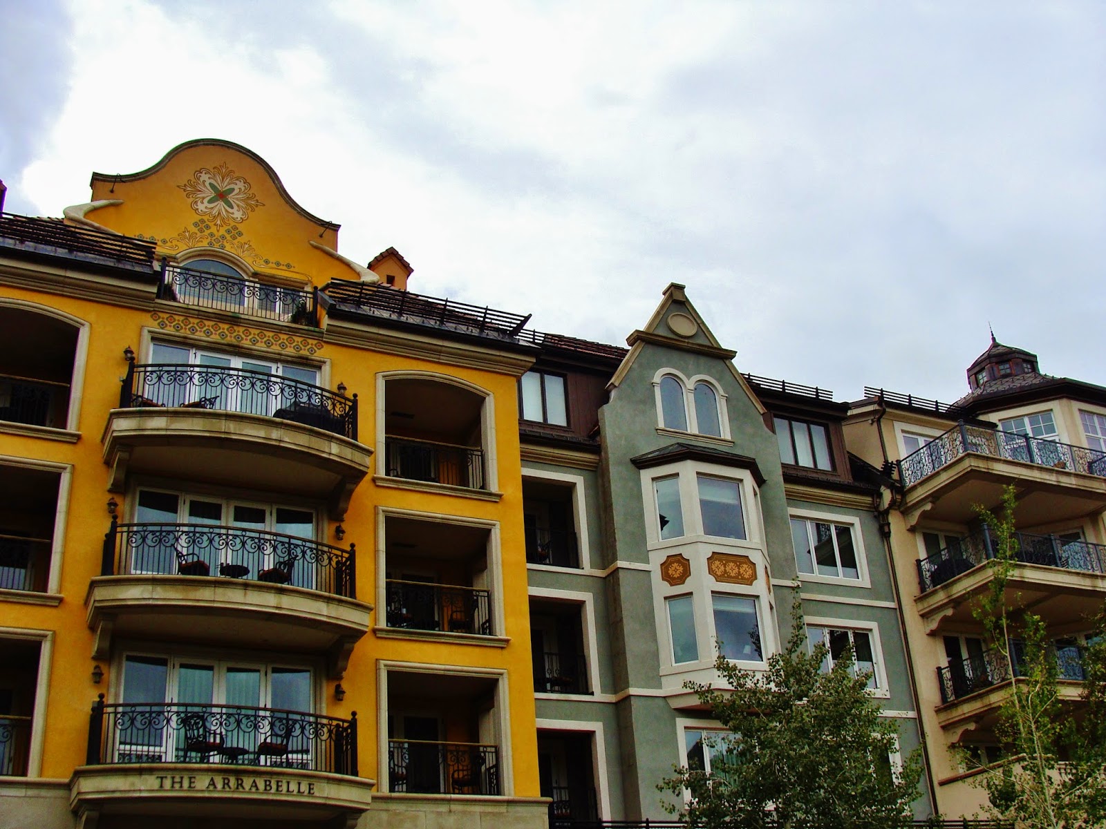
Vail is very different and you can tell right away that it is a “modern” town built around the ski industry, and yet it reflects a very European feeling with the architecture reminiscent of what one sees in Alpine communities in Austria.


On my list of places to see here was the Betty Ford Alpine Garden.  The GPS location was incorrect but I was given clear directions from the gentleman at the security gate of the shopping complex as to how to get to the Ford Park and Gardens. 

Betty Ford Alpine Gardens in Vail 
Just a short drive brought me to the parking lot and the weather was kind to me, it stopped raining and the sun came out!  It was so lovely to stroll in the gardens and enjoy the alpine and perennial blossoms, the beauty of the plants and the artistic design.


The final stretch for the day included massive climbs and incredible descents as I passed through several passes. 

Road side stop for scenic view near Silverthorne 
During that last part of the drive there were several stops along I-20 to see scenic overlooks. 


Georgetown Colorado 
There were also some stops to see historic old towns and railway history. 


view from my room at Indian Hot Springs 
It was early evening when I finally arrived in Idaho Springs. After driving through the town I arrived at Indian Hot Springs and got a lovely room in the historic part of the inn.  It is on the second floor and it feels like I have stepped back in time at least 100 years…except there is a TV on the wall and an electric alarm clock by the bedside!


Indian Springs:


After settling in I went down to the hot spring fed pool and just lounged around in the lovely warm water and reminiscing about the last time that I was here with my sister in Sept 2009 when we went on our Yellow stone park adventure.  I enjoyed chatting with some of the people also enjoying the warm waters and it was 1.5 hours later when I was all wrinkled and prune like that I finally made my way back to my room to check my messages and upload one more blog.  My dropping eyelids told me it was time for lights out.

Renate Dundys Marrello 
2014 - 08 - 28 


Sunday, October 12, 2014

2014 – 08 – 27: Day 36 – Road Trip Across the USA - Route 6 east - Along the Colorado River

From Colorado River State Park, Fruita Colorado 
To Glenwood Springs 
Distance traveled:  98 miles

I woke up to rain!  I did some reading while waiting for a dry opportunity to pack up the car.  


a walk along the Colorado River 
The clear patch lasted long enough for me to enjoy a short walk along the Colorado River and take in the view of the muddy brown waters and the mountains on the horizon. 


From Fruita I tried to follow the old section of route 6 through several towns.  You have to read the signs carefully or you end up back on I-70.   


Colorado River in River Bend Park 
It rained off and all morning, and the sky remained gray and overcast.  In Palisades I found “River Bend Park” where I enjoyed some quiet time by the river side until it started pouring once more.  Still in a relaxing frame of mind I did some Sudoku in the car before driving on.

Colorado River State Park - Island Acres 


The old route follows the river closely for a little when and then 6 ends / or becomes I-70.  There is only the one road through this canyon section.  I stopped at the Colorado River State Park – Island Acres section, for a stretch break and then continued on the road through the picturesque canyon.

Yard art in New Castle 


Continuing east I was able to stay on some more bits of old Hwy 6 through Parachute, Rifle and New Castle.   It was raining of and on all afternoon as I made my way to Glenwood Springs. 

Rain while entering Glenwood Springs 


I decided to stay at the Glenwood Inn to get out of the rain.  It is a very quaint a pretty place, and I was soon settled in for some picture editing work.  


The sky cleared up as I ate my dinner and showed a glimpse of the sun.  Then the thick and dark clouds came back with a promise of more rain. 

I had hopes of rafting on the river tomorrow, but with this weather it does not make it look promising. 

Renate Dundys Marrello

Wednesday, October 8, 2014

2014 – 08 – 26: Day 35 – Road Trip Across the USA - Route 6 east - Crossing into Colorado

From Lake Utah State Park, Provo Utah
To Colorado River State Park, Fruita Colorado 
Distance traveled   232 miles

Sunrise over the mountains 
I was up very early, before the sun had even cleared the mountains to the east.  I looked at my watch, it was 5:30. 


I did start my regular morning camp routine with the unusual – a basin bath wash-up.  There are no showers at this camp ground!  I can't believe it!  So after the previous night at a primitive camp site with no shower I needed to freshen up.  I put on fresh clothes and then washed the ones I had been wearing.  Maybe I should have done this last night – with all the wind they would have been dry by morning.  Oh well, I packed them wet and will hang them to dry in the evening.  

Then my usual routine of breakfast and breaking camp and I was all done by 7:30.    

Lake Utah 
For my first stop I went over to the beach on Lake Utah and went for a hike along the waterfront. 


what a collection
Then I left the park and stopped the storage place with an incredible collection of old signage and memorabilia.   


From there I drove to Spanish Fork to return to hwy 6 once again. 

There was a McDonald’s right at the corner so I stopped for a coffee and wifi and did some messages and replies.  I cleaned the windows as best I could (need to get some windshield washer fluid today) and then it was on the road once again. 

mountain pass east of Spanish Fork 
The next stretch was very scenic with curving mountain roads. I was surprised at how many trucks use this route.  They are crazy on the downhill slopes, coasting as fast as the slope takes them, overtaking all the other vehicles that slow down for the corners.  The speeds for the corners were signed at 45 or even 35 MPH.   But there were trucks passing me at well over 60.  I was amazed!

scenic overlook near Helper 
I stopped whenever a scenic overlook presented…but there were not very many so many of my pictures are from behind the steering wheel.   


Prehistoric Museum in Price 
In Price I got off the hwy to drive through the town and stumbled across the university run Prehistoric Museum.  I spent almost 2 hours there enjoying the amazing displays.  I have to add to my bucket list – time in Utah exploring the dinosaur digs!  They allow regular people to participate as volunteers…that should be fun.

As I was leaving Price I saw a Walmart and stopped for the windshield wiper fluid and bought 2 gallons…Mel told me the empty container takes that much.  This time I was successful at finding the latch and soon had poured 1 ¾ gallons into the repository, just a little bit left for topping up later.

Dark storm clouds over the distant mountain range 
Back on the road it was easy following route 6 to Green River.  I stopped once at a rest station to eat some lunch and watched a big dark storm front moving in from the south west.

At green River route 6 merged with I- 70 and it stayed that way until I crossed the Colorado border.  The storm front was always on my right hand side never getting any closer but also not dissipating.  After another rest stop (near where the exit to the Arches National Park is located), I motored along on I–70 some more.  

 Back on route 6 at Mack Colorado 
Finally I saw the sign for Mack and taking the exit I quickly found route 6 once again…and also the sign going west that said the road ends…verifying my supposition that the original route 6 in this area is not always a through road.

Along route 6 I passed through Loma and into Fruita where Colorado River State park is located.  I started to think that I might have crossed a time zone…I don’t think Colorado is on Pacific time!   After entering the park and paying my camping fee I set up camp and asked a fellow camper what time it was.  I was right, I am in a new time zone and so I had to reset my clock to 6:30.   

more storm clouds in Colorado River State Park 
As the sky got progressively darker I worked quickly to set up camp.  I barely got set up, warmed up my can of soup for dinner and ate before the rain caught up with me.  Putting the last few items into the car to protect them from the wet I too climbed into my car living chamber and settled in with my Sudoku then my notes.

The rain has now passed and the light is fading. There is still a dense cloud cover and I wonder if it will rain some more tonight?  


Time to do some picture editing work and then get some shut eye.  I am feeling the effects of long days on the road and am wondering if I should settle in for an extra day here, or make a very short drive tomorrow instead of the distance I had originally planned.  I will see how I feel in the morning.

Renate Dundys Marrello
2014 - 08 - 26 

Photo Link: 

Tuesday, October 7, 2014

2014 – 08 – 25: Day 34 – Road Trip Across The USA - Route 6 east - from Nevada to Utah

From Charcoal Ovens State park Nevada
To Lake Utah Lake State Park Utah
Distance:  241 miles along route 6

It rained during the night, so hard that water was coming inside.   That meant that  I had to start the car and close windows.  I am assuming that this is a “monsoon” rain just like what I experienced  when at the north rim of the Grand Canyon.  It also got very cold and by morning I needed my second sleeping back to keep warm.

Sunrise at Charcoal Ovens State Park 
I woke up early started the day watching the sunrise over the desert.  At 5am the sky was mostly grey with a large band of pink to the east.  It was early enough to see the moon rise, however, there were clouds…making for a glorious sunrise, but obscuring crescent moon. 


I packed up my lonely camp site, yes I was still the only camper as no one arrived late in the evening or after dark.


Charcoal Ovens 
A very short drive brought me to the site of the Historic Charcoal Ovens that were of such importance to the mining in the area.


Willow Creek 
There was a short hiking trail nearby which I followed through the desert scrub to see a small river.  There was not much to see because so many plants and grasses were flourishing in the moisture.   The whole area was lush with flowers and shrubs and even small trees.


I had thought to have breakfast at the “Willow Creek Trading Post and Store“, which I had spotted last night on my drive in to the campgrounds.  However,  it was only 7 am and they did not open to 8.

I encounter cattle on the road 
While driving back to the highway along the gravel road I encountered some free ranging cattle along the road.  It was fun watching them run away from me and my car as I got closer.  There was this one big black fellow, that was right in the centre of the road and he was galloping quite fast heading off to the north into the open plain.  

Continuing along Route 6 I drove past the entrance to Great Basin National park.  This did not qualify for a “stop” because it is over 12 miles off the main road so did not meet my criterion for “on route 6”.   However, it will certainly go on my list for a “destinations and activities” adventure which I can already see unfolding in my mind and happening in the future. 

At the Utah border there was a gas station and restaurant where I stopped for breakfast.  I really enjoyed my poached eggs with hash browns and coffee.  

I also enjoyed a conversation with the two couples at the next table.  They are traveling and exploring together. After talking with them I pondered how a road trip would be experienced differently with a group rather than a solo traveler.  There are times when the quiet is an opportunity for ne to take in a magnificent site without the distraction of conversation.   There are other times I feel the need to share my emotions and vocalize how moved I am by what I am seeing and experiencing.   I think I am starting to feel the aloneness of this trip.  When I travel in Europe many nights are a private B&B’s where you chat and share time with the owner.  Camping and motels do not give that same opportunity for socializing.  I also wonder if it is the incredible long stretches of driving through almost barren lands that has me feeling this melancholy nostalgia for company.

When I started the car again a light came on the instrument panel.  Oh my, what is wrong with the car?  It had me worried, it looked like an engine and I was concerned that I would need to get repairs or cut my trip short to head straight home.  

I drove to the town of Delta, with anxious thoughts in my mind about what repairs I might be needing.   The sounds of the engine were normal.  There were no unusual noises.  


The warning light that has me concerned 

In the town of Delta I stopped at the McD’s.  I took a picture of the engine light and used the wifi to contact Mel and sent him an email with a picture of the light so he knew what I was talking about.  Then I called him on Skype.  

What a relief it was when he said it was not a major problem.  It was the breather light signaling that the oxygen intake was not as balanced as it could be.  Probably because of all the altitude driving I have been doing, he said it could also be some bad fuel in the line.  So next time I get to a Walmart I have to buy a fuel additive.  

With a sigh of relief I was able to continue on my way.  I got some top up gas so I don’t run out on some of the barren stretches still ahead of me. I have been keeping to an even 60 mph and the Volvo just loves that speed, I am getting great gas mileage.  After putting in the top up gas, the distance showed 840 to empty and the gauge was not even all the way to full.

I continued my drive east on Hwy 6 toward Spanish Fork where I hope to stay at Utah Lake State Park, I am hopeful that this one will have electric sites and that being close to Salt Lake City, I won't be the only camper.

This stretch of the drive through Utah was very pleasant, but still very empty of human habitation.  Vast acres of desert valley interspersed with mountain ranges to be crossed. 

Sand storm in the distance

Yellow flower blowing in the desert winds 
I saw another sand storm off in the distance.  


I had a lovely rest break in a rest area, the wind quite blustery and because of this even though the day is hot I continue to feel quite comfortable.


Log Cabin display in Eureka 
In the town of Eureka I spotted this historical log cabin.  I stopped to investigate and found it to be this little free museum, a tribute to the early settlers of Utah. 


The further east I got the less desert like the landscape, the fields are greener and the towns, thought still small are closer together. 

Payson Utah 
The closer I got to Salt Lake City the more built up the area got.  Soon I was getting the “suburban” feeling that comes when you get to the outskirts of a big metropolitan area.   In Provo there was even a Sam’s Club for gas.  I went inside for some fruit and got a hot dog combo for my dinner, a change for camping fare.

The final drive for the day was a short one, to the Lake Utah State Park where I picked a camp ground with a bit of shade and settled in for a relaxing evening.  Now the clouds started pulling in too and left me wondering what will become of my sunset.

I had an electrical site this time so I could recharge all my gadgets;  J   I had a lovely camp site with a small tree for partial shade.  The picnic table was also sheltered and the breeze was blowing so it was quite comfortable even with the temperature at 28C

Sunset on Lake Utah 
I was facing west across Lake Utah and I was hoping for a unique sunset behind the mountain range.  However, the clouds that have been following me every day since I have been heading east once again obstructed a clear view.   So I enjoyed what I had and made the best of it.


As soon as the sun went down it got cool and it was nice to climb into my car bed and shelter from the now quite strong wind.  I even had to close the hatch because it was too cool.  I got my sleeping bags arranged and ready and settled in for some picture downloading and some catching up editing. 

Renate Dundys Marrello
2014 - 08 - 25 


Photo Link: