Wednesday, June 1, 2016

2015 – 07 – 16: Scenic Destinations Day 32 - Explorations along the Missouri River


From Chamberlain South Dakota
To Yanktown South Dakota 
Total Distance Traveled: 214 miles

Today I picked a route that would criss cross the Missouri River several times. The plan was a scenic route not a direct one.  I started out  by backtracking on I-90 westbound to  to route 47 south through Iona and Dixon.  

route 47 southbound 


I was a sole vehicle on the road much of the time.  


White River as seen from the route 47 bridge 


I got to cross the White river close to where it merges with the Missouri. 


Often all the company I had were the horses and the  cattle. 


There were some amazing views from higher elevations.  Rolling lands and winding roads makes for interesting driving and viewing.


Francis Case Memorial Bridge see from parking area on the western bank 


I loved the Francis Case Memorial Bridge on route 44 and drove slowly across it so I could enjoy the mighty expanse of the Missouri River.


On the eastern end of the bridge I discovered a quaint chapel with delightful stained glass windows. 


After driving through Platte I headed south on route 50 to drive through Yankton Reservation and the town of Geddes. 


route 18 discovery center overlook to Fort Randal Dam 


The next turn off was on route 18 taking me to the town of Pickstown and from there just a short drive to the 
Fort Randal Dam. Here there was a lovely display and historic discovery centre with loads of learning possibilities and the view was also amazing. 

Missouri River seen from route 2 
Now I retraced my way back along route 18 to go to Marty a small town along 388th Ave. in Yanktown Reservation Lands. This brought me to route 2 that often gave me  glimpses of the Missouri River far off in the distance. 

Through more farmlands and rolling country side I arrived at route 37 south toward Chief Standing Bear Bridge.


The view from the roadside stop toward Chief Standing Bear Bridge and the Missouri River really gave me a greater understanding of just how big this river is. 


And on the far side looking back toward the distant rolling hills and sand bars in the river I felt dwarfed by the sheer size of this waterway. 


The river here is the border between South Dakota and Nebraska.  As I now turned east onto a short stretch of highway 12 also called the “Outlaw Route”.  (future adventure possibilities!) I was in the state of Nebraska and traveling through Santee Sioux Indian Reservation making my way toward Yanktown.

I stayed on the Nebraska side of the river at a  lovely river side camp site just below Gavin's Point Dam.  

Now I settled in for my evening routine, relax, cook dinner (seasoned beans and ham), do my laundry, take a shower, and general clean up. 

My reward was to watch the sun setting over the Missouri River to the west which here faces up stream. The  sky is fading with light shades of pink and orange. I am so tired I can barely keep my eyes open.


My last trip to the washroom is rewarded with seeing dozens and dozens of lightning bugs everywhere!  This is the first time I have seen them so close that I actually could make out the whole bug and realized that the "light" flashes are on the "tail" and that after "flashing" it goes dark.  


My final view was looking up into the nigh time sky and seeing lightning in the sky far to the north. 


Renate Dundys Marrello
2015 - 07 - 16


Link to see all of the day's pictures 

Link to my Facebook Reflections Page


Route map for the day


Friday, May 27, 2016

2015 - 07 - 15: Day 31 Scenic Destinations - Following the Missouri River


From Pierre South Dakota
To Chamberlain South Dakota
Total Distance Traveled:  100 miles

I awoke this morning with a sunrise view out to the Missouri River. 


This spot is claimed to be one of the places where Louis and Clark stopped on their exploration of this river system.  It is an incredible feeling to look out upon a river and imagine that this would be the same scene that they would have looked upon and maybe even have written about in their reports. In the semi darkness of dawn the modern world it hidden and I can almost imagine the wilderness around me as they would have experienced it. 


After breakfast and breaking camp I started exploring Pierre.  My first stop was a hill top view to the Missouri river and the distant view to the west


In Pierre I explored the government state building,


...and the nearby statue of the "Fighting Stallions" and a lovely hike around the lake.


Then I headed to the water front parks for a view of the river and a historic site, the original 1 room school house 


My next stop was just west of Pierre to see the view from the Oahe Dam.


Then I started the drive south along the Missouri river.  For the next few days I will basically be following a section of the "Lewis and Clark Trail"


I started traveling on the south side of the Missouri River on Road 1806. This was an amazing drive with some spectacular views to the river. I loved the scenery, the odd old abandoned building and the way from the tops of hills you can see the panorama of the river spread out below.


A large part of the drive was through reservation lands with well cared for beautiful farms.  I know very little about these things so I was wondering how they are managed?  Are the lands managed as a tribal community project or are parcels owned by individuals?

Near Lower Brule is where this particular parcel of Native American land ends. Just past this town I had to leave the quiet byways and return to the interstate, I-90 for a bit.  


At Chamberlain the interstate crossed the Missouri River. The size of this river is well appreciated when you see the size of the bridges crossing it.

By this time it was late afternoon and I decided to stop here for the night.  I used my evening time to post a travel blog even though I have no illusion that I will remain current while traveling.  

Then I settle in to watch the sun setting behind the hills across the Missouri River. The display of amazing stunning colours never ceases to fascinate me. 


Renate Dundys Marrello
2015 - 07 - 15 


Link to see all of the day's pictures

Link to my Facebook Reflections Page


Route maps for the day 
today's route map 


Wednesday, April 20, 2016

2015 - 07 - 14: Day 30 Scenic Destinations - last day in the Badlands


From Cedar Pass Camp Ground Badlands National Park
exploring Badlands National park - 41 miles 
To Pierre South Dakota - 124 miles 
Total Distance Traveled:  165 miles 

I awoke to the sun rising above the peaks of the badlands and started my day in awe of the surrounding beauty.  

After breakfast and packing up, I explored the White River Valley by driving west along Hwy 44.  
                                      
In a small town called Interior I found these amazing old wagons by the side of the road.


Further west I turned north toward Canata along Conata Basin Road.

Along the road I enjoyed the prairie landscape, the prairie dogs and the grazing cattle.   

This road brought me back to north back to 240 the scenic loop through the Badlands National Park.  


I stopped to take a hike at Saddle pass.   It was a lovely yet vigorous climb to the top of the drop off. Imagine the difficulty of this climb bringing a dissembled wagon down the steep incline.  Pioneers had some incredible stamina and determination. 


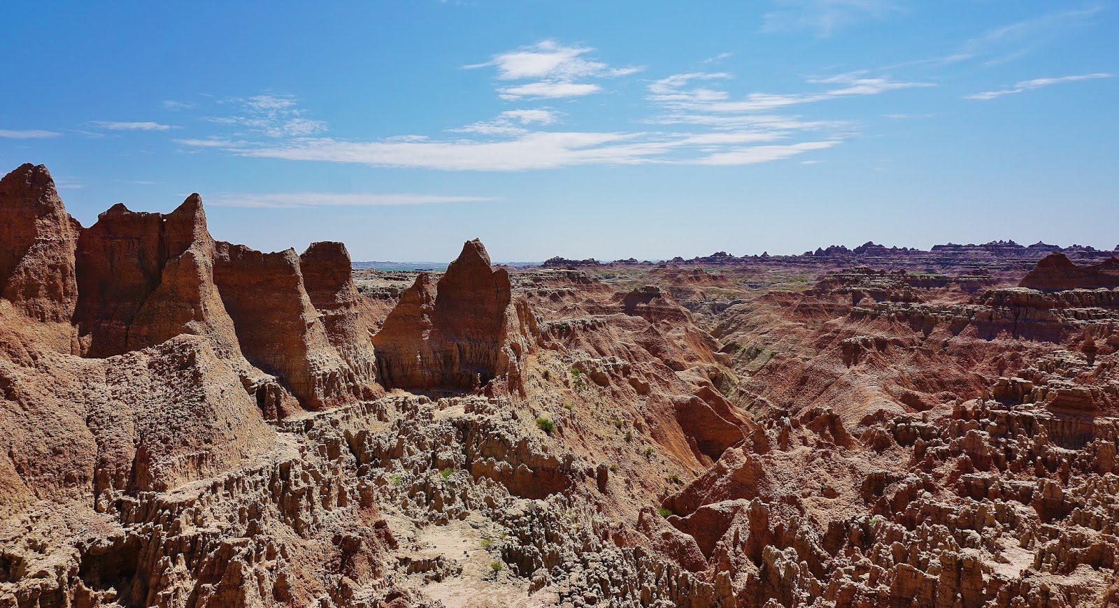
The view from the stop of the pass was stunning and spectacular! 


Climbing down this trail, as always was more challenging than going up.  The rock is loose and slides out from under your feet, some bum sliding is required simply to stay at a slow enough speed that you don't go toppling over the edges.  


I continued the drive along the scenic road back to the Ben Riefel Center where I stopped for a much needed rest room break.  Then I headed back onto the eastward bound road out of the National Park.  

There were a couple more scenic overlooks to explore and photograph. From Window Trail there some spectacular views that really brings how the size of the natural feature.  


The final stop was at Big Badlands overlook.  Looking out from the tameness of a laid out park plan it is mind boggling how the early explorers must have felt in the land of unending rock faces.  

The aboriginals new the pathways for hunting and survival, white man would not have this knowledge.  They only saw farm potential.  

It took many years before people started to realize that beauty is a valuable commodity, something for people to come and enjoy and appreciate.  

I think even now, we often take that for granted. How many of us take the time to ponder and respect the awesome aspects of nature that are not directly linked to our survival. 

Leaving the National Parklands I stopped at Prairie Homestead Historic Site. Since it is not run by the National Park there was an extra admission fee.  I decided to just walk about and see the exhibit from outside the fenced in area.  


I stumbled upon a prairie dog and had fun observing him.  


Then I took a few pictures of the old homestead before heading on. 


On I 90 I headed east to Muurdo, where I had to stop and take a break as the glare from the sun was making me sleepy and want to shut my eyes.  A lunch stop and rest was just what was needed.  I found a lovely picnic area right beside a body of water and the trees offered a shady respite.

Once on the road again, I headed east to the Hwy 83 exit to head north toward Pierre.  

The drive through the Pierre National Grasslands was majestic.  The undulating waves of uninterrupted grasslands as far as the eyes can see, dwarf my car in comparison.  I am adrift in an ocean of grass.  The drive is mesmerizing.  

It was a relief to finally arrive in the outskirts of Pierre just for the change of scenery. I imagine the wagon trains who traversed the seemingly unending miles of plains for days and days covering in 3 or 4 days what I drive in one hour. 

In Fisher’s Lilly Park there are $10.00 camping sites so I pitched my tent and settled in with a gorgeous view of the Missouri River near where Lewis and Clark stopped.  I organized my campsite and did the usual work of sorting and tidying to set up a welcoming place to stay.  Needing a break after absorbing so much visual input over the last few days, I decided to just sit around reading and enjoying the view of the river flowing by.  Tomorrow will be soon enough to go exploring.  Tomorrow begins my Lewis and Clark trail exploration as I try to stay as close to the Missouri River as I can.
Renate Dundys Marrello
2015 - 07 - 14  


Link to see all of the days pictures

Link to my Facebook Reflections Page

Route maps for the day 

#1  exploring the Badlands National Park 

#2  road map from the park to Pierre